This is the first edition of the new and improved PDF LOG Blog.
YOU CAN CLICK ON PHOTOS TO SEE THEM LARGER….USE YOUR BROWSER BACK BUTTON TO RETURN TO THIS PAGE.
We have a web site that we don’t use much so why not post the log to the blog and make life simple…It also gives me more room for verbosity than an excel data block and I can format things to look normal.
When I rode with Steve Swartz the other day we discussed hiking as well as riding. Last winter Apache and I did a good bit of hiking on weekends. We did a lot of exploring at Poor Farm Park and discovered miles of trails. We did a couple of miles there at the end of last week. Steve asked me if I had ever hiked at the North Anna Battlefield Park. I told him I had been to the park but had never hiked any trails…He suggested I try it and said he hikes there a lot. Apache and I decided to try it out this morning. We waited until the sun came out and warmed things a little bit and then we ventured out…
I thought the park was a small one to commemorate a minor battle from the War of Northern Aggression. I was wrong on both counts. The battle was a fairly significant engagement and is explained in detail by the many markers along the trail. And the park is not small. Apache and I did both the Blue Trail and the Gray trail. There are several other trails that we did not venture down. The trail map box was empty so we had no idea where we were going. When we began I reached for my GPS and realized that it was sitting on the desk behind me as I type this….I had left it there after downloading my last adventure….So I do not have an exact measurement of how far we went. However having a little trail experience I estimate that we did about four and a half miles. I will GPS it when I find the strength to do those trails again.
It is a beautiful park and the trails are mostly paved with a good layer of rock dust….they are certainly dryer than the trails at Poor Farm Park. Several bridges and culvert pipes span the frequent water features. There are numerous markers to relate the events of import and the layout and action of the battle as well as still existing trenches and earthworks dug over 150 years ago. We were surprised at the number of cars in the parking area and the number of people we passed on a Monday.
This park is not for the faint of heart or for the infirm. I did not see it when we embarked on our adventure but there is a sign to that effect at the trail head. I took a picture of it as we exited…..When we started Apache was trying to tow me along…..When we got back his pace was a little more reserved and patient.

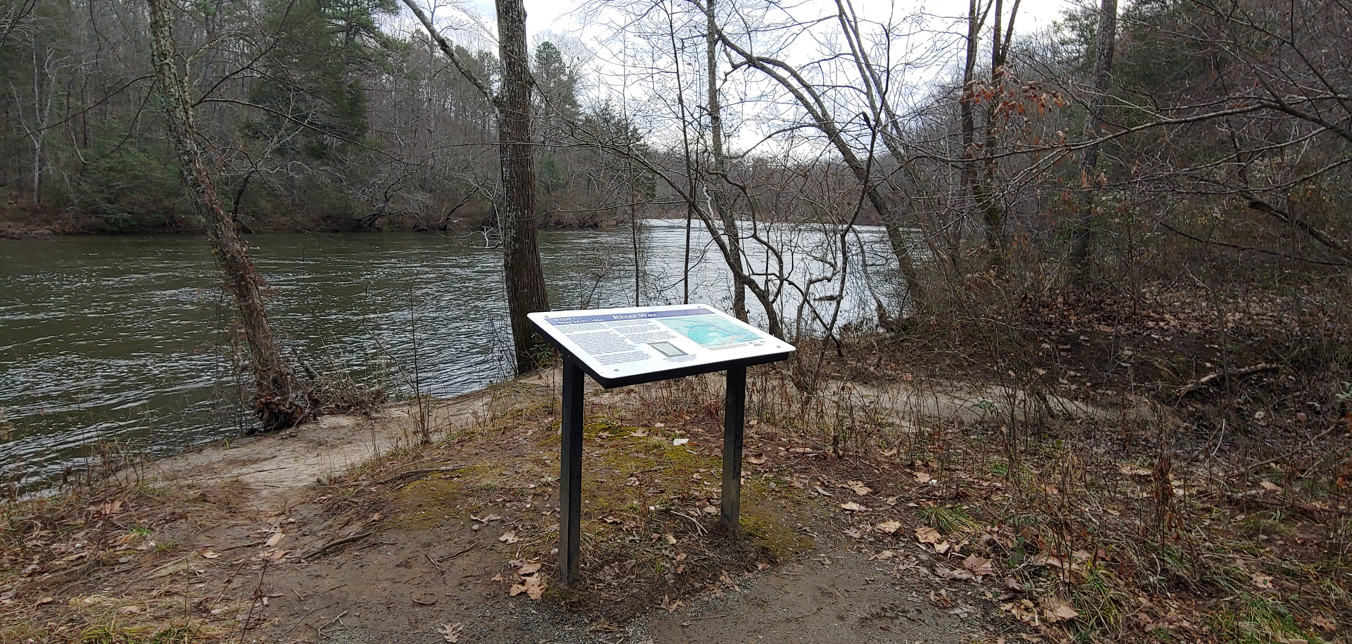
This battlefield was an attempt by the Northern Army to cross the North Anna River above Doswell, Va. The Southern forces were arrayed mostly along the hilltops overlooking the South side of the North Anna River. One of the trails took us all the way to the River. The signage indicated that there was an intense storm the first night of the battle and in the steep and rolling land every bottom had a flood of water racing to the river. The River was probably roaring as it was today. We had a pretty big storm just a couple of days ago and all the streams are swollen. I took a picture of it but the photo cannot convey the roar that I could hear downstream. We heard it from a half mile away before we ever saw it.

Had I been a union soldier someone would have had to shoot me to get me to enter that water in an attempt to cross it. Somewhere just out of sight downstream there was apparently a dam or a narrows which was causing the roar of the water we could hear but it was just out of sight. I don’t know how deep this river is here but it is not wadeable and was moving with some velocity…. And if the soldiers survived the river there are immediate steep hills to climb with the southern army pouring rifle and cannon fire down upon the heads of those attacking. The hills were numerous and steep. When we finally got to the trail that winds along the river I looked up at the hills above me and tried to imagine what it must have been like to try to climb those hills while being shot at by an entrenched enemy.

The Blue trail ended at a point on the river pictured above. There was about a half mile back track along the river and then a long steep climb. We noticed a shortcut that some hardy souls had been taking and guessed it went straight up the hill and intersected with the trail along the crest of the hill. We decided to try it as it was significantly shorter, maybe a hundred yards up a hill and we had to climb that hill one way or the other. This path did not have blue stone dust on it. It was a path thru the woods leaf covered and steep….VERY STEEP…..things were going along okay until we hit a real steep spot and a foot slipped on the wet ground. I managed to grab a sapling and get a foothold. I crabbed sideways and got off the path and off the slick ground. Worked my way over to a tree and paused to catch my breath….we were about half way up and I looked down and realized I was in a bad way and could not go down…I would not have ridden a horse down that trail….knew I could not keep my feet under me going down….we looked up and saw a way to use trees for support and handholds and stay off the slick trail and with a couple of more rest stops we reached the summit and the path.
I am getting too old for this foolishness….at least I was not being shot at…….next time I will stick to the paved trails. Once we got back on the blue stone trails it was safer….but still several big hills to navigate….It was a fun outing.